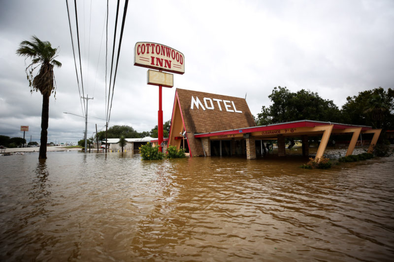
Since Hurricane Harvey, questions have been raised about why so many homes and businesses flooded in the first place. Now a peer-reviewed study in the journal, Environmental Research Letters suggests one possible answer: because the federal flood maps people have been relying on are wrong.
Mark Collette, an investigative reporter with the Houston Chronicle, says the maps that FEMA uses to set insurance rates represent just one point in time.
“They are based on what they know about streams, and rivers, and lakes, and rainfall, and development when the map is published,” Collette says. “And really think they actually look backwards, because a lot of times they use old rainfall data.”
In addition, FEMA maps don’t cover all waterways. As an example, Collette says that in Harris County, there are about 23,000 miles of rivers and creeks, while FEMA only mapped around half of them.
That is why the University of Bristol, in conjunction with the Environmental Protection Agency and other organizations, tried to use better data to capture the flood plains across the entire country in their study, which shows the lack of more accurate and widely available flood maps. And one of the reasons for that is bureaucracy.
“The real problem here is that with other things that involve huge government agencies, the process for creating and updating these maps is really bureaucratic,” Collette says. “It’s limited by budgets, and there are provisions in the law that allow people to challenge the process, so if the community get a set of proposed flood maps from FEMA and they don’t like it because their insurance rate are going to go up, they have an opportunity to appeal that map.”
That’s the case in Galveston County, where new maps were proposed in 2013, but a part of the community appealed. The process is still going on, five years later, which means that by the time those maps come out, they will already be several years old.
“The appeals are only successful if they can prove than they are technically correct,” Collette says. “But if an appeal is successful, it affects everybody in the community, not just the people who are protesting.”
The study makes clear how outdated the FEMA mapping process is and indicates things that should be kept when the necessary changes to the National Flood Insurance Program take place.
“There is a lot of people calling for reforms in the National Flood Insurance Program,” Collette says. “There’s a bill that the House passed earlier this year that tries to shore up the mapping effort, but it really doesn’t do a whole lot in that regard.”
Written by César Lopez-Linares.