
This story originally appeared on Houston Public Media. Audio will be available shortly.
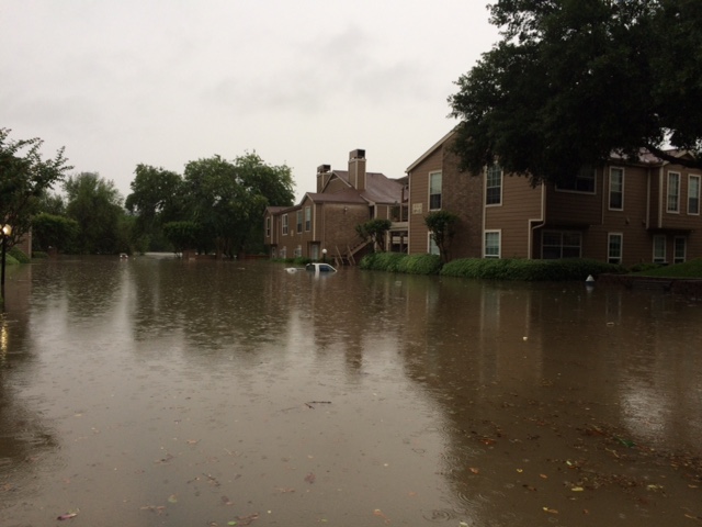
Make no mistake, the experts say this was one bad flood.
“It was a flood of massive proportions,” says Phil Bedient an environmental engineer doing flood research at Rice University.
“It was very very widespread and it also came very, very quickly. It came at the worst possible time,” says Bedient.
The waters rose in the darkness of early morning. But you might have been warned if you got weather alerts on your smartphone.
“People were awakened in the middle of the night with these alerts, that is very useful, a big step in the right direction.”
But what do the alerts actually tell you?
“Well you know these following counties are going to be under flood watch or flood warning, whatever,” says Bedient.
But he and other researchers have been looking for ways to provide far more detailed warnings; as in, which neighborhoods might flood and how badly. One project developed in part by the University of Texas is about to become operational nationwide.
“The weather service is going to be forecasting water like it forecasts weather,” saysDavid Maidment, at UT-Austin’s Texas Advance Computer Center.
He’s been helping develop the National Flood Interoperability Experiment. It will go into operation this June at the National Weather Service. It’ll use a supercomputer to crunch data not only about rainfall amounts but also about the capacity of creeks and bayous to carry that water. It’ll predict the flow at 2.7 million spots on those waterways nationwide. In Texas alone, at over 100,000 spots. In Harris County, at 875 locations.
“You’ll be able to anticipate where the water will be, how deep it will be, how much it will spread out and so on,” says Maidment.
So forecasters will be able to say in a more pinpointed way, here’s the area that may be flooding within hours? “Yes, that’s right; this is going to be a very large increase in the nation’s capacity for flood forecasting once it becomes fully operational,” Maidment told News 88.7.
Maidment says it could mean local emergency officials will be able to make quicker more accurate decisions on where to close roads or where to expect to make high-water rescues. And he says the media could give much more specific warnings.
“I hope the television stations will use that to say here’s the storm coming and not just to expect two to four inches of rain or something like that but here’s the kind of flooding that could result from that so the people can prepared for it,” says Maidmont.
He says the forecasting models the National Weather Service will put into operation this summer could provide those more accurate forecasts hours, even days, in advance of when water will begin to rise.