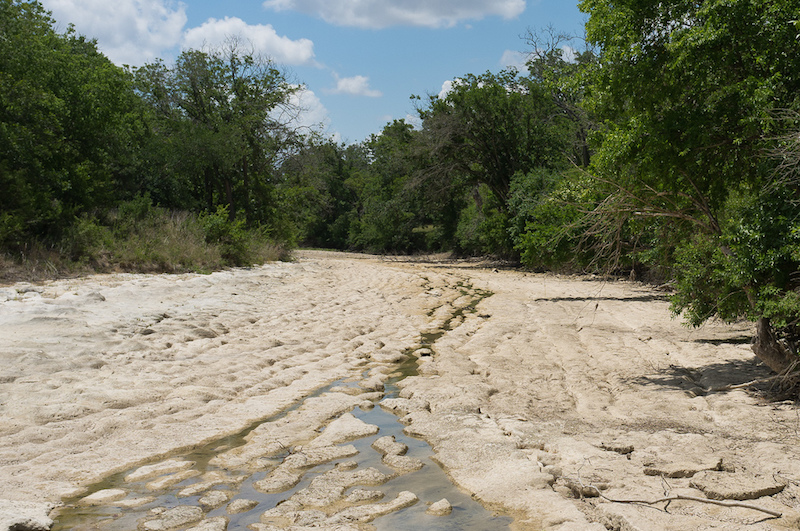
The latest U.S. Drought Monitor map shows Texas is free from drought: less than 2 percent of the state is “abnormally dry,” a huge improvement from this time last year.
Lakes are filling up and plants are green, but by now, most of us have come to grips that patterns prove drought will be back someday. Texas’s long-term water security isn’t guaranteed. Of particular interest is groundwater, which doesn’t replenish the same way surface water does.
Colorado-based analyst Samantha Fox, a database developer for Ponderosa Advisors, has been learning a lot about Texas groundwater. Fox helped develop an online tool called WaterSage.com.
“We think of it like a Google maps for water and land,” she says. “There’s a plethora of data available in the West for water rights and land but our mission was to make it really accessible, from a single landowner to an organization of attorneys or realtors.”
The paid database, Fox says, shows who is drilling wells and look up who has water rights at nearby water sources. “Basically, it provides information about where water is being used, for what purpose, and can show you trends in water use,” Fox says.
Fox says Texas makes many of their water records available for the public, so the tool is more to provide a way for citizens to educate themselves about the more than 100 groundwater districts in the state. With groundwater depletion becoming an issue across the West, Fox says monitoring water use will become more important.
“Since people have traditionally been able to pump as much as they wanted, pretty much, from under their property, that is starting to evolve,” she says. “With stewardship comes some management.”