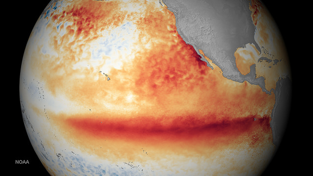
You remember the headlines: the strongest El Niño on record was supposed to last well through the winter and produce wetter than normal conditions. But right now, much of Texas is facing a literal dry spell as swaths of the state face increased wildfire risks. Some areas haven’t measured any rainfall at all in 2016. What happened?
Meteorologist Victor Murphy with the National Weather Service says that the weather pattern is still alive and well, even if it “hasn’t been kicking” lately.
“The bottom line is this is still, since 1950, still tied with ’97-98 as the strongest El Nino on record,” Murphy says. “Texas as a whole did have the wettest October through December on record going back to 1895.”
El Niño ebbs and flows, he says. The pattern is in flux, and just because it’s dry right now doesn’t mean the weather event has completely fizzled out.
“Like stock market, when its going up, it doesn’t go up constantly or day after day after day, you do have peaks and valleys,” Murphy says.
The bottom line? El Niño is still going on, and expect that rain to return soon.
“We do expect above normal precipitation or above normal rainfall to return to Texas, looks like starting around March 1 or so and continuing through the spring,” Murphy says. “So arguably, we need to enjoy this lull while we have it – hopefully for the next week or two before it turns wet again.”
Listen to the full interview in the audio player above.


