From Houston Public Media:
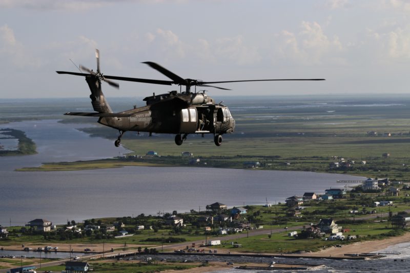
It’s not long after sunrise at Sholes Airport on Galveston Island. Four Black Hawk helicopters from Fort Hood are being loaded up with journalists and with officers from the U.S. Army Corp of Engineers as well as officials from FEMA, the federal disaster agency.
“We’re the busiest region in the nation and I think that’s what makes us better is to take all those lessons learned from all those different events. We have disasters every year, we face disasters every year,” says Laverm Young, FEMA’s deputy director for Region 6 that includes Texas and its four neighboring states.
The lessons learned from Hurricane Ike eight years ago were the point of an aerial tour and a meeting that officials would attend the next day.
The tour started by flying about a mile to where Ike damaged the Galveston Island Seawall, resulting in the first major repair to it in over a century. It then headed across Bolivar Peninsula where, if you didn’t know better, you might find it hard to imagine that Ike killed 15 people here and destroyed hundreds of homes. Now, there are hundreds of new homes built along the beach.
We cross over the Gulf Intracoastal Waterway, the canal that Ike clogged with debris but which on this day had a line of barges plying its waters.
We then fly northwest, skirting downtown Houston until we’re on the far west side. Below us are the great, green expanses of the Barker and Addicks reservoirs. They’re mostly dry now, just big forests, but in April during the Tax Day floods, they broke records, holding back more storm water than they ever had since being built just after World War II.
That flood and a couple other subsequent storms delayed by six months a $75 million project to replace the big gates on the Addicks and Barker dams.


