The Panhandle saw an outbreak of tornadoes last night and a new line of thunderstorms are expected to sweep through the Big Country, northwest Texas, and into western Texoma starting this afternoon.
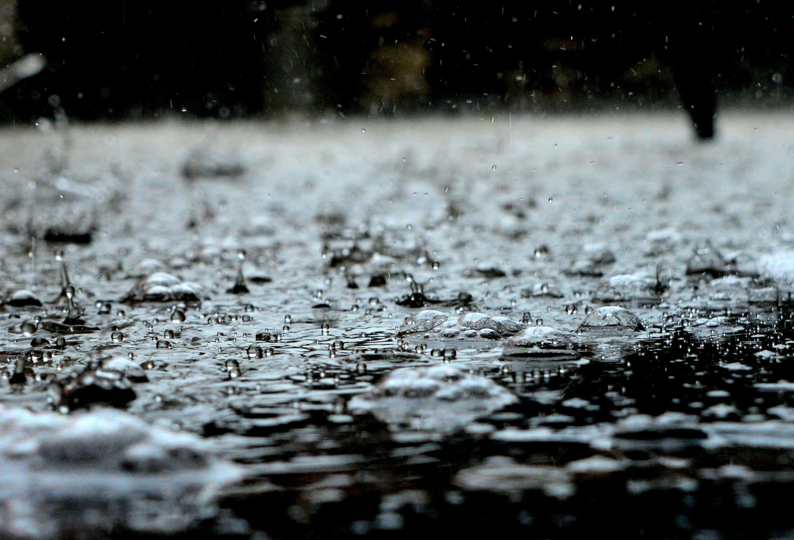
We are far from out of the woods. More rain is forecast in the Brazos Valley, Golden Triangle and southeast Texas – and it’s not just flooding that’s cause for concern.
Eric Berger is meteorologist with Space City Weather based in Houston, and he joined Texas Standard to talk about what we can expect in the coming days. Listen to the interview above or read the transcript below.
This transcript has been edited lightly for clarity:
Texas Standard: Panhandle twisters last night – I heard seven up there, as well as this report of wildfire dangers out west. And then you’ve got the flooding. As we head through today, Eric, what and where are you most concerned about the weather outlook for Texas?
Eric Berger: Well, I’m very concerned about the area north of Houston, with the Lake Livingston, Lake Conroe areas and points north. They did get an incredible amount of rain last night, dealing with some very serious flooding issues.
It does now look as though a line of showers associated with that is going to move through Houston today, in this afternoon. And so I expect some significant disruptions, some flash flooding in the Houston metro area today, which largely had been spared up until this point. And then fortunately, after that, it does look like things are going to quiet down a little bit, in terms of rainfall here. But it’s certainly a big mess in terms of flooding.
» RELATED: Polk County residents evacuate from Trinity River flooding
Now, when you talk about Houston, you’re talking about street flooding downtown. Is that a concern?
Potentially, yeah. It really depends on where the showers set up.
Right now, the heaviest rains are just north of the city, near places like Kingwood, Bush Intercontinental Airport. But it does look like they’re going to sag southward toward the coast during the next few hours.
To what extent did these rains offset persistent drought conditions statewide? I mean, is there a silver lining? I’ve heard that sometimes when you have waterlogged dirt, that it takes like, what, four weeks for it to dry out or something like that?
Well, that depends a lot on the temperature. And the time of year with the sun angle – certainly in Texas during the months of May, June, July and August when it’s sunny and hot – grounds will dry out much, much more quickly than they will in the winter.
We were having kind of a dry spring, certainly in the eastern half of the state. But it certainly has turned much wetter in the last couple of weeks. And so I don’t have real major concerns about a drought this summer. And even looking kind of longer term, it does not look like we’re going to see a repeat of really just the baking dry conditions we saw last year in much of Texas.
» GET MORE NEWS FROM AROUND THE STATE: Sign up for Texas Standard’s weekly newsletters
Well, that’s good news. What about shorter term, though? As we talk about these storms sweeping across Texas, when are we going to see some relief? We’re talking about sometime over the weekend? Monday, perhaps?
Well, it depends on how you define “relief,” because we’re going to replace this storm system, by and large, with high pressure. As high pressure comes in, that does mean that we really settle down, across a lot of Texas. But it does mean that temperatures are going to go up.
So we’re going to see next week, we’re going to see sunnier weather, probably temperatures in the low 90s – mid-90s in some locations in Texas. And combined with humidity, it’s going to feel the warmest it has felt since last September/October.
Broadening our scope beyond Texas, I read yesterday there had been something like 350 tornadoes in the U.S for the month of April. That’s nearly double the five year average for the month. What’s behind that?
It’s really hard to say without having done a reanalysis, but we’ve just seen a very active storm pattern, and this really is the time of year. You still got colder air up north, lingering from the winter. But the Gulf states, it’s been very warm here along the Gulf.
We saw a lot of really strong winds this past weekend. And that’s just an indication that there’s really an unsettled pattern in the central United States, very low pressure and so forth.